Concept · Glossary
Weather Halo
Also: the weather halo
Definition
The ~50-point-per-year swing in raw satellite greenness on any piece of land that is driven by weather rather than management. EcoIntel's weather-corrected scoring strips it out.
The Weather Halo is one of the single most important things to know about remote-sensed ecological indicators, and almost nobody outside the remote-sensing community says it out loud.
Raw satellite greenness moves by roughly fifty points per year on any given piece of land, independent of management.
Think about what that means. A land manager who makes no changes at all will see their NDVI swing by fifty points between a wet year and a dry year. A land manager who makes excellent changes in a dry year will see their NDVI apparently fall, because the weather pulled it down faster than their management pulled it up. A land manager who does nothing in a wet year will see their NDVI rise and pat themselves on the back for a grazing plan that did nothing.
If you judge your land on raw greenness, the weather will fool you, in both directions, every year. Whole policy debates about whether “regenerative” methods “work” have been conducted on data that is mostly recording whether it rained.
The fix is not to abandon the satellite. The fix is to separate the two signals: the signal of management from the noise of weather. EcoIntel does this with parcel-specific climate covariates from ERA5-Land (stress-week counts, vapour pressure deficit, AET/PET ratio) integrated directly into the prediction model. The end result: a climate-detrended trajectory that reflects decisions, not rainfall.
On sites where raw NDVI swings fifty points a year, the climate-detrended trajectory typically moves by a handful of points around a clear management signal.
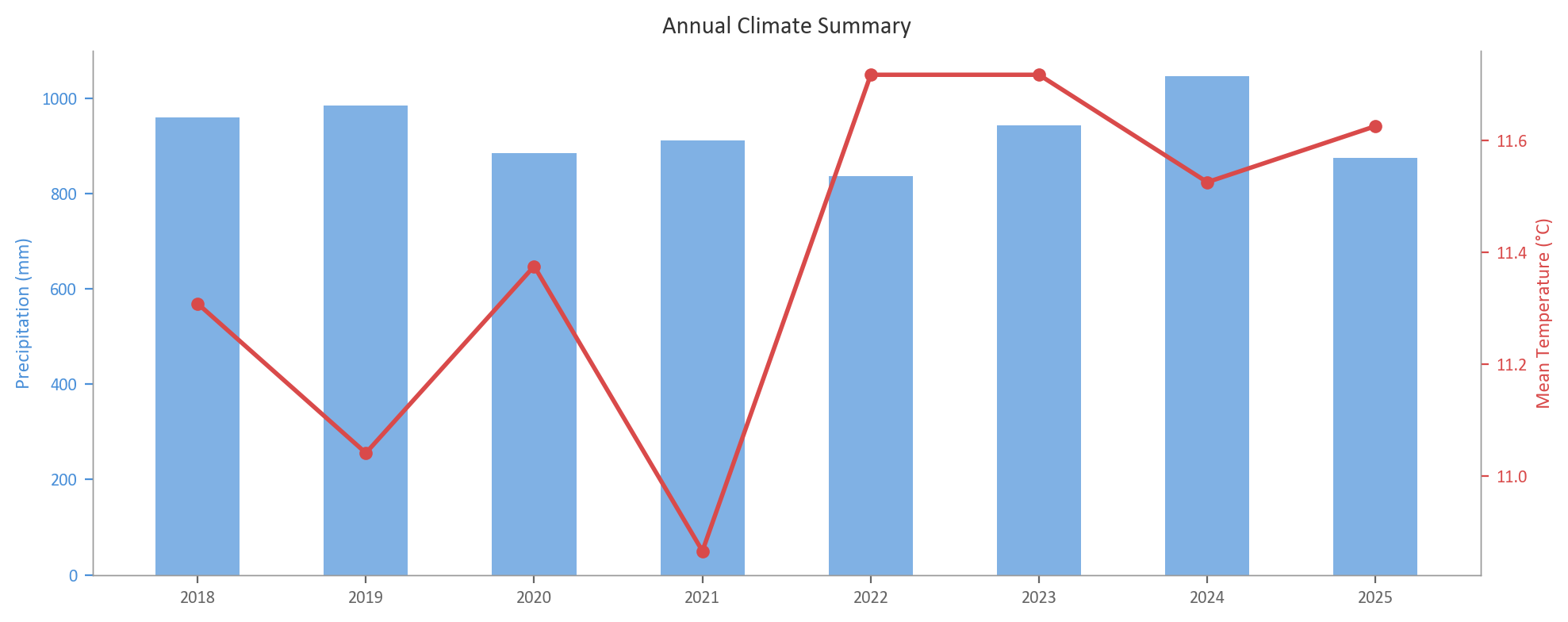
Eight years of climate context for Wilder Wood Farm, the variability the Weather Halo correction has to absorb before management signal becomes visible.
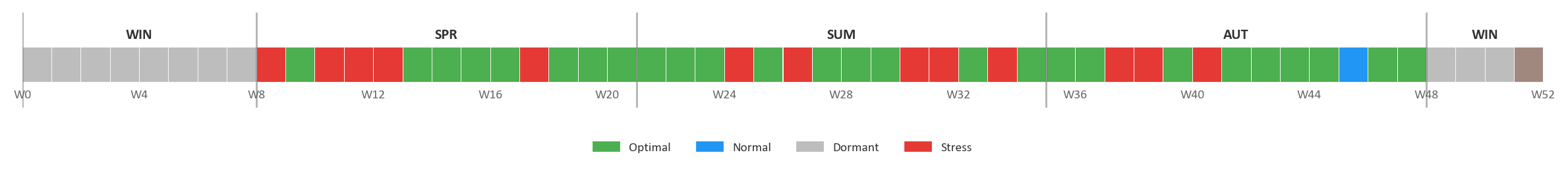
The climate context at week-by-week resolution for 2025. Green = optimal growing conditions; blue = normal; grey = dormancy; red = stress. EcoIntel uses ERA5-Land covariates at this resolution (stress-week counts, vapour pressure deficit, evapotranspiration ratio) to detrend the Weather Halo out of satellite-derived ecosystem-process scores.