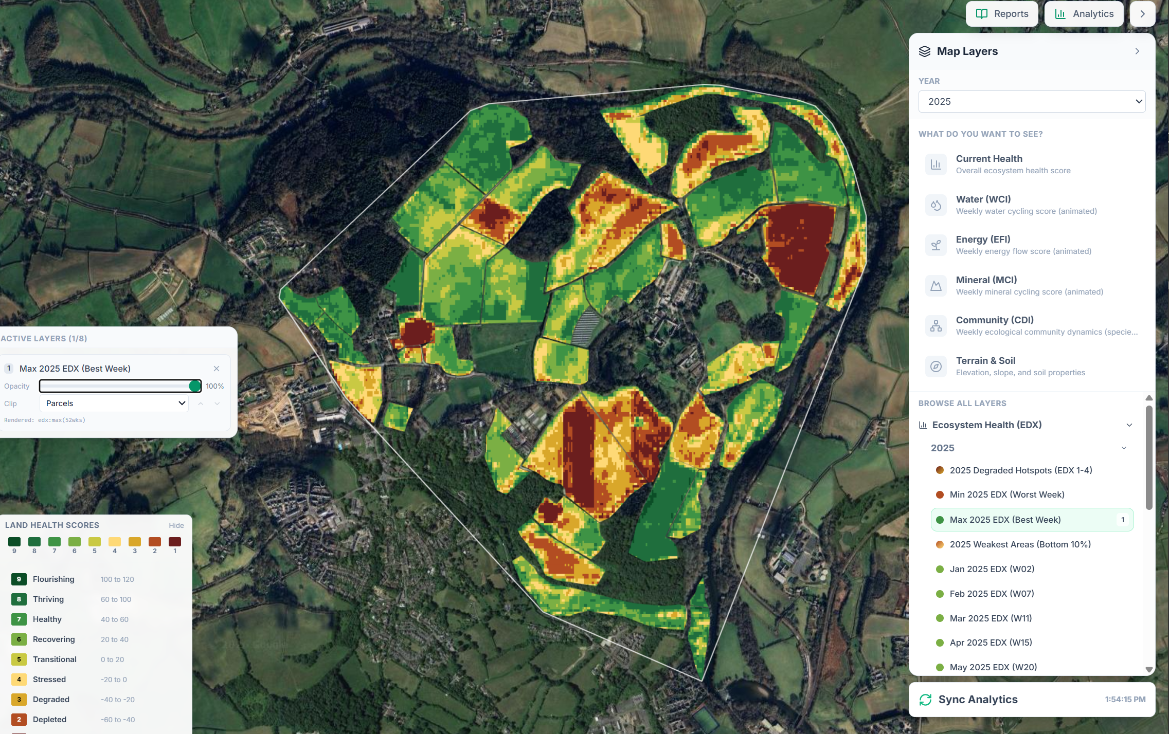
Land Health Reports
Two packages. Six possible deliverables. One Land Health Score per property.
Every EcoIntel subscription includes a suite of reports built around your property's Land Health Score (1 = Collapsed, 9 = Flourishing). The reports are written for different audiences and decisions: from a 10-minute brief to a 100-page diagnostic, plus a disclosure-grade report for corporate subscribers.
-
Standard
For property owners, farmers, and land managers
Five reports. A complete diagnostic, a 10-minute reader's digest, a decision-pack for governance meetings, a per-parcel operational reference, and a satellite atlas of your property.
-
Corporate
For corporate sustainability and ESG teams
Six reports. Everything in Standard, with the master expanded to include a corroborated carbon section and a disclosure chapter, plus a dedicated ESG Sustainability & Disclosure Report aligned to five regulatory frameworks.
At a glance
| Report | Standard | Corporate |
|---|---|---|
| Baseline Land Health Assessment | ✓ | ✓ (extended) |
| Land Health Brief | ✓ | ✓ |
| Strategic Action Brief | ✓ | ✓ |
| Field Operations Profile | ✓ | ✓ |
| Visual Property Atlas | ✓ | ✓ |
| ESG Sustainability & Disclosure Report | – | ✓ |
| Authoritative Carbon Corroboration (within master) | – | ✓ |
| Sustainability & Disclosure chapter (within master) | – | ✓ |
The reports, in detail
Every report is generated from the same scoring engine, the same satellite history (back to 2018), and the same Land Health Score. They differ in what they say to whom, and how much detail they show.
-
Standard + Corporate
Baseline Land Health Assessment
The full diagnostic.
A page from the Baseline diagnostic for Wilder Wood Farm. Your property's complete ecological diagnostic in a single document. Verdict and diagnosis first, supporting evidence next, methodology last.
What's inside
- The Verdict: one paragraph naming the score and explaining why
- Editorial Summary: a multi-page narrative read of the property
- Executive Summary: the property profile and headline numbers
- Strategic Brief: assessment, diagnostic, and actionable insights
- Diagnostic Synthesis: what's working, what's limiting, what the multi-year trajectory shows
- Context: ecoregion, topography, climate, brittleness, land cover and history
- Water cycle, Living systems, Carbon & productivity: the four ecosystem processes diagnosed in depth
- Risk Assessment: per-parcel risk matrix and mitigation hierarchy
- Opportunities: prioritised intervention map
- Field Seasonal Profiles: per-parcel seasonal dynamics
- Methodology & Confidence
- Glossary
Corporate edition adds
- Authoritative Carbon Corroboration: your carbon figures cross-checked against 14 authoritative public reference datasets
- Sustainability & Disclosure chapter: a framework-aligned summary ready for ESG inclusion
Perfect for: The one report you cite in any conversation about this property's ecological state.
-
Standard + Corporate
Land Health Brief
The 10-minute read.
Everything you need to know about your land in ten pages. Bulleted, plain-spoken, designed to be read cover-to-cover in a single sitting.
What's inside
- A four-bullet headline: your score, where you sit within the band, your trajectory, and what that means
- One paragraph per ecosystem process
- Field Action Summary: every parcel, colour-coded
- The Ecosystem Chain: why the processes matter and how they connect
- A short carbon note
- Methodology and confidence
Perfect for: The owner who wants the answer without the appendices.
-
Standard + Corporate
Strategic Action Brief
The decision pack.
A governance-grade brief built for the meeting where you decide what to do next.
What's inside
- Strategic Brief: assessment, diagnostic, and actionable insights in three structured paragraphs
- Risk Assessment: per-parcel likelihood × impact with mitigation hierarchy
- Opportunities Map: prioritised interventions with colour-coded urgency
- Trajectory: explicit statement of what's holding the land back
- Confirmation requests: satellite-detected events awaiting your validation
- Methodology and confidence
Perfect for: A sustainability VP, consultant, or trustee briefing themselves before a 15-minute decision conversation.
-
Standard + Corporate
Field Operations Profile
Field by field.
One detailed card per parcel. The operational reference for the person walking the ground.
What's inside
- Physical Character: elevation, slope, aspect, area, landform, topology
- Management Assessment: plain-English read of how the field is functioning
- Seasonal Dynamics: quarter-by-quarter signal
- Grazing Recovery profile (where relevant)
- Shade Analysis (where relevant)
- Field outlook: closing summary
Perfect for: The farm manager, contractor, or grazier who wants the picture for each specific field they're working on this week.
-
Standard + Corporate
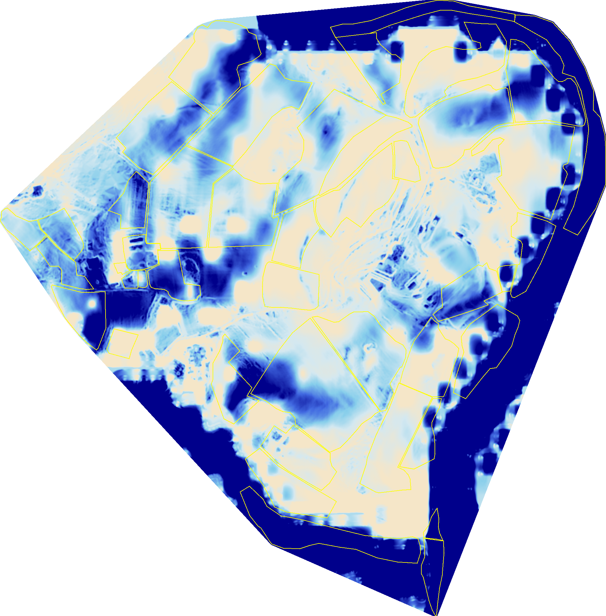
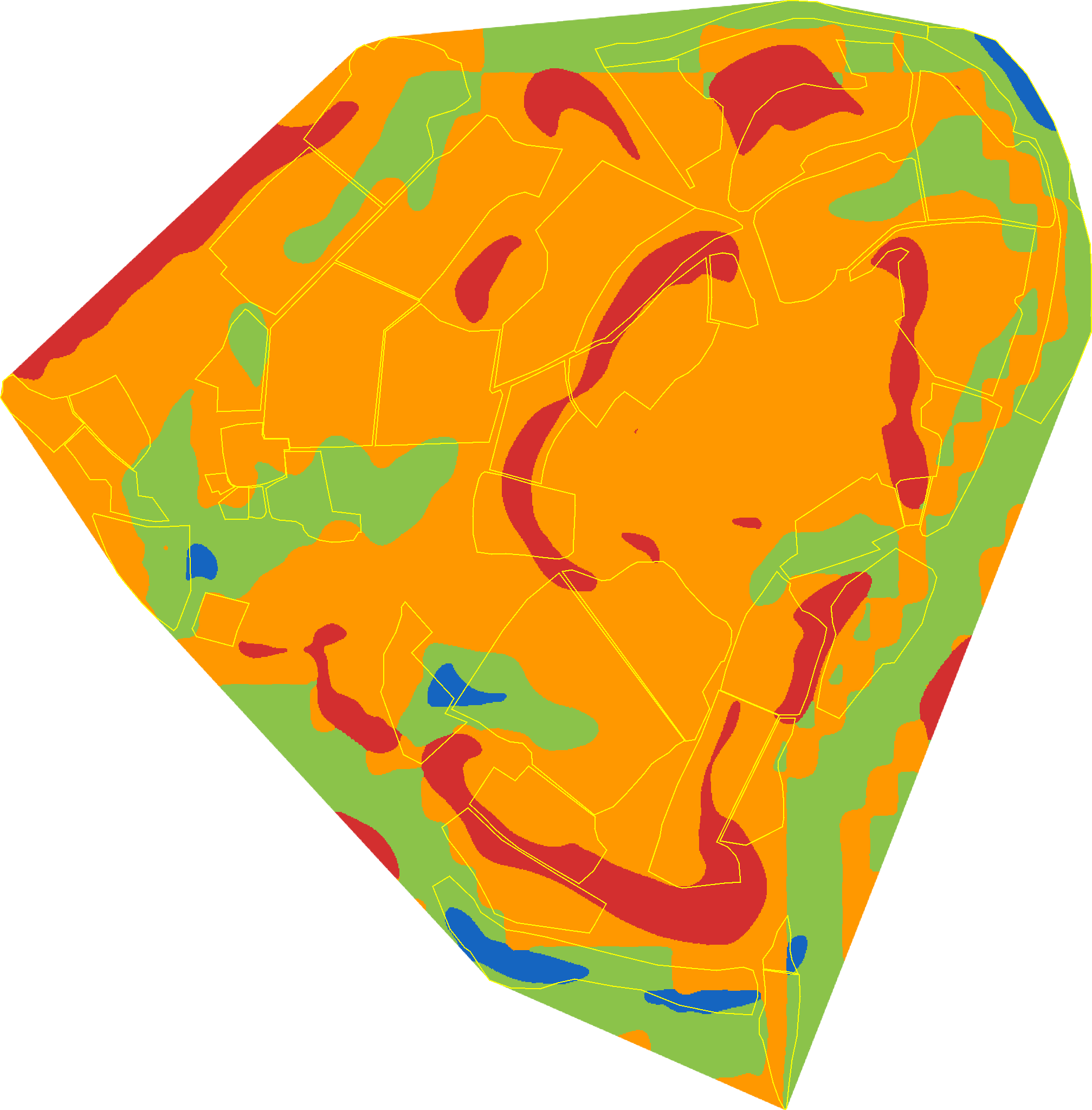
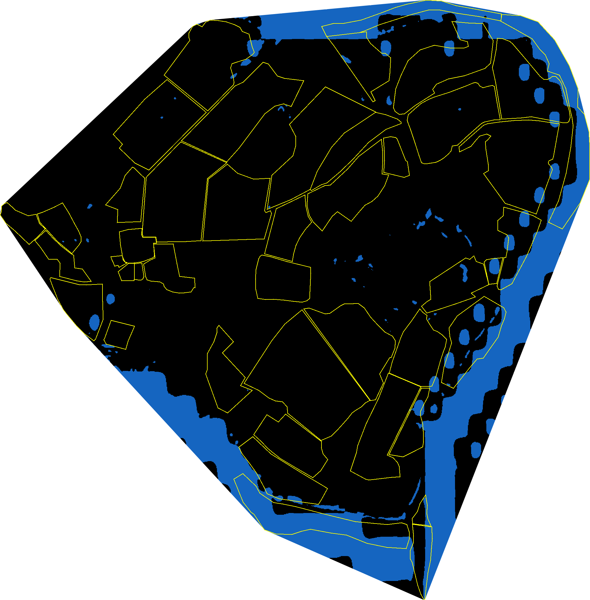
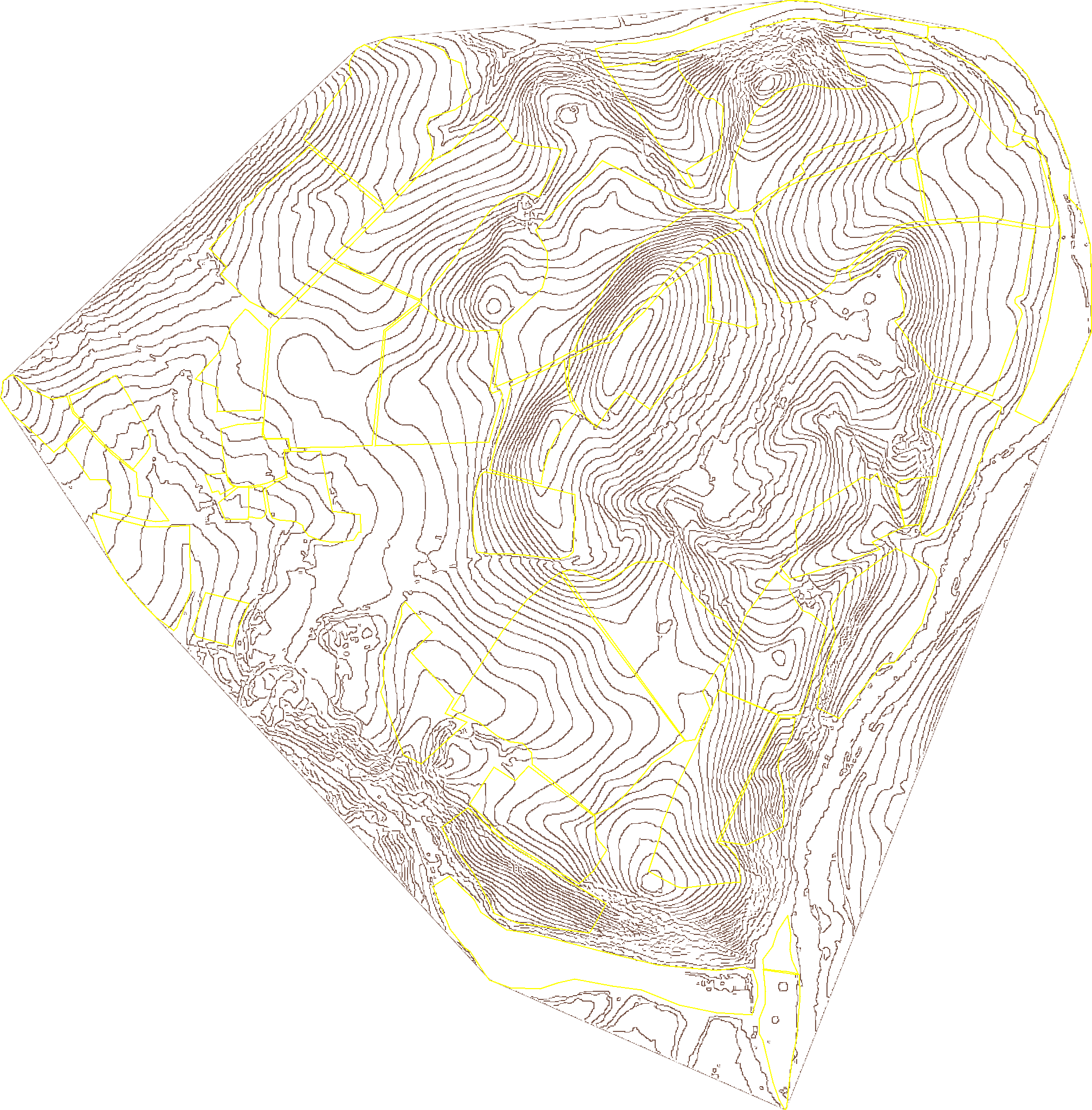
Visual Property Atlas
Your land in 15 satellite layers.
Your property mapped, layer by layer, with plain-English commentary alongside each image.
-
-
-
-
-
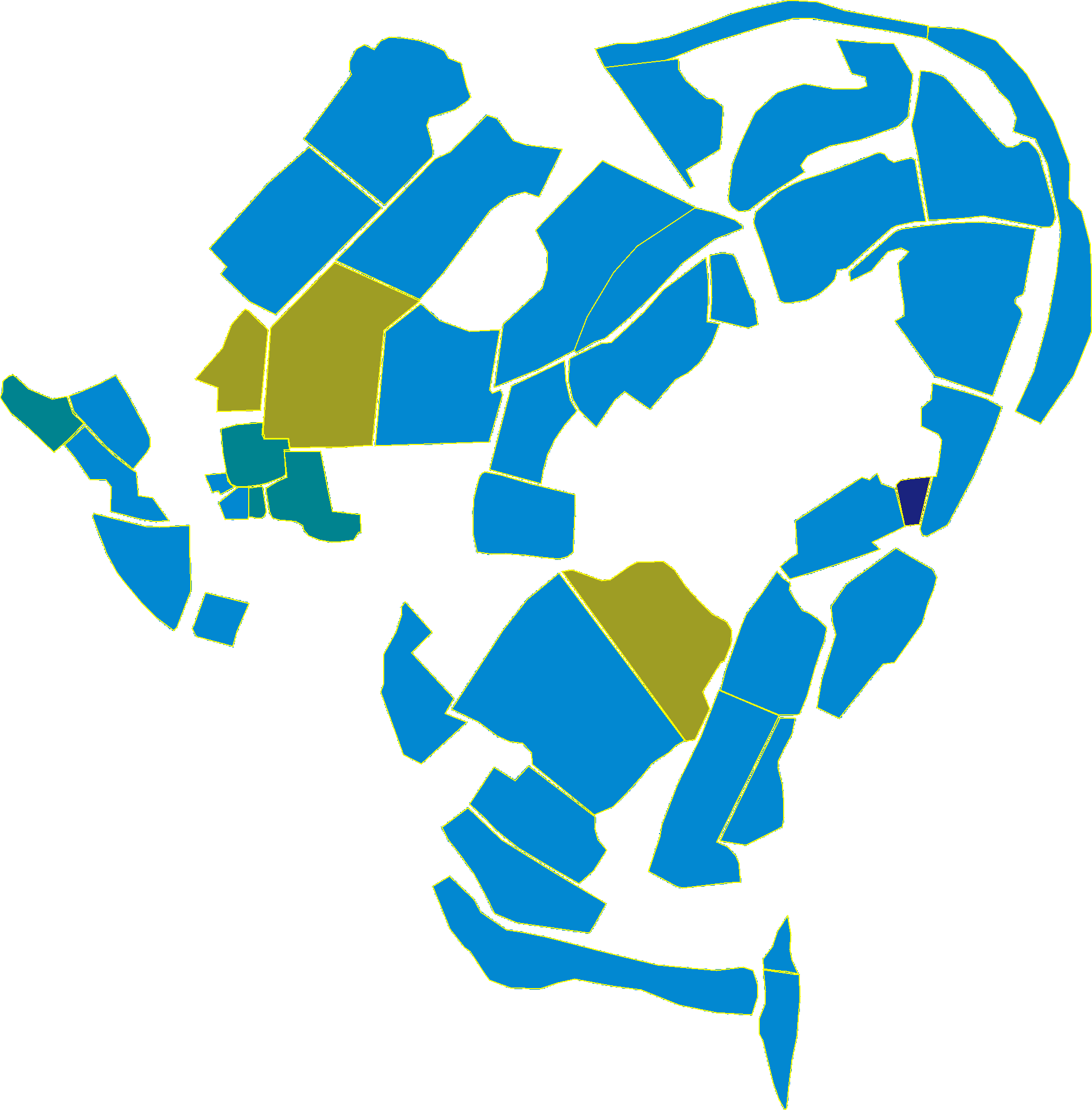
Five of the fifteen-plus layers from the Visual Property Atlas, on Wilder Wood Farm. What's inside
- Orientation: your property in its landscape context
- Field boundaries on satellite imagery
- Winter hillshade: ridges, valleys, drainage lines
- Slope, aspect, elevation
- Topographic Wetness Index: where water collects vs. sheds
- Land Health classification (current year + multi-year trajectory)
- Land cover types
- Tree canopy cover
- Above-ground biomass
- Soil organic carbon
- Disturbance timeline (forest properties)
- Cumulative carbon sequestration
- Opportunities Map
- Risk Matrix
Perfect for: The visual learner, the consultant presenting to a board, or anyone who wants to see what the numbers describe.
-
-
Corporate only
ESG Sustainability & Disclosure Report
Disclosure-grade. Five frameworks. One report.
A sustainability disclosure report structured to align with the major frameworks corporate ESG teams report against.
What's inside
- Property overview and headline Land Health Score
- GHG Protocol (Land Sector) alignment: net carbon balance
- ISO 14064-2 alignment: greenhouse-gas quantification
- TNFD v1.0 (LEAP) alignment: Locate, Evaluate, Assess, Prepare
- ESRS E4 alignment: Biodiversity & Ecosystems
- ESRS E1 alignment: Climate Change adaptation
- Framework matrix showing where each disclosure number derives from
- "What's needed next": what client-side data or further work would lift indicative status to fully provided
- References to SBTN-FLAG, CSRD section 29b, and EU Taxonomy DNSH where adjacent
- Confidence and limitations
- Glossary including framework-specific terminology
Perfect for: Corporate sustainability teams preparing nature-related disclosures, ESG analysts, and the auditors who review them.
See it on the demonstration property
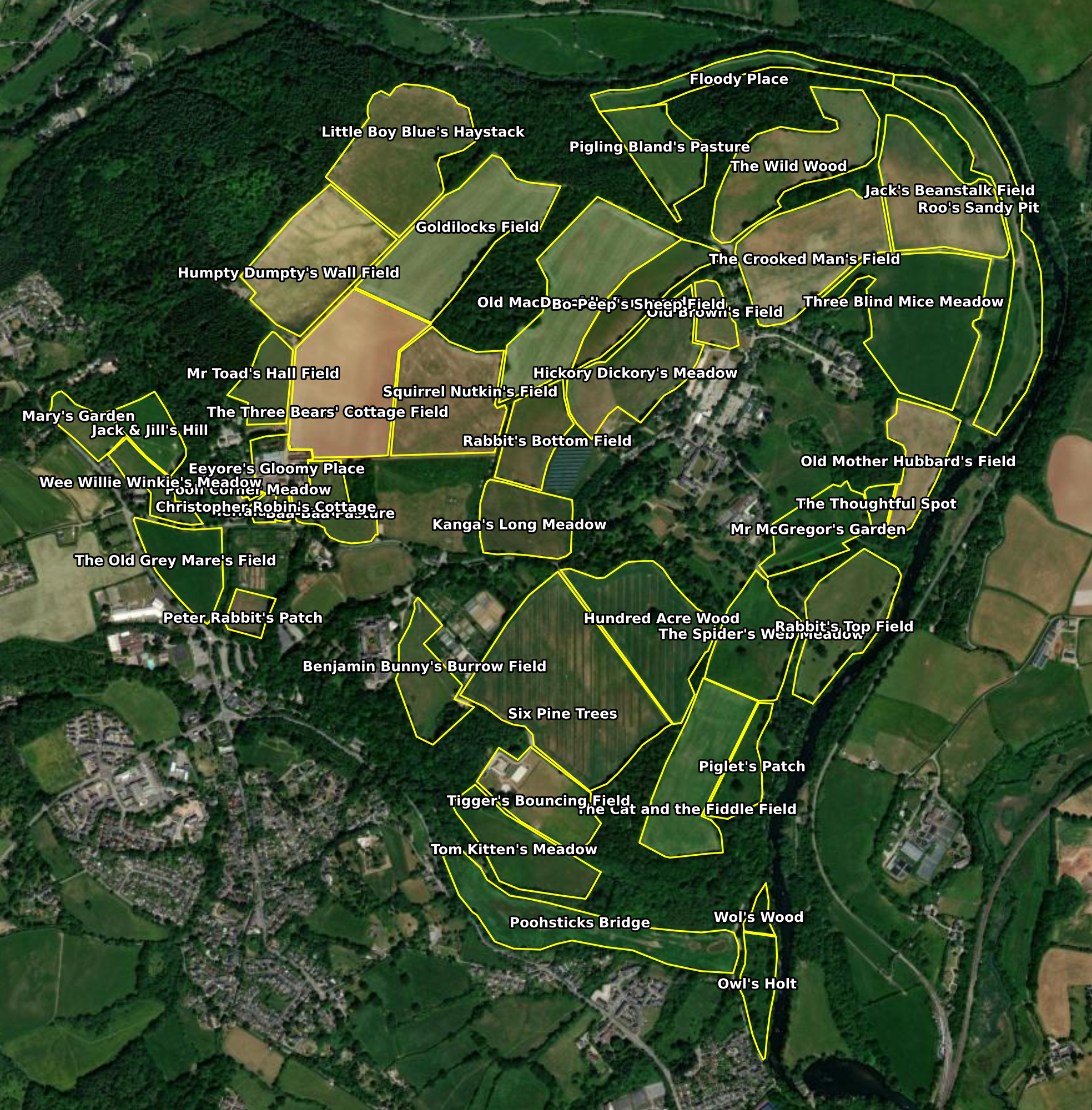
Wilder Wood Farm is our public demonstration property: a 175-hectare family estate in the fictional county of Davonia (Atlantic Central ecoregion), 44 fields, eight years of satellite history. Sign up for free to open every report in the suite as it would appear for your own land: same scoring engine, same prose, same depth of analysis.
Typical turnaround for your property: normally within hours, always within two working days.
Want to see the reports on your land?
Sign up for free to open the full Wilder Wood Farm report suite, or talk to us about a Corporate disclosure engagement.