
Land Health Credential
Wilder Wood Farm
A mixed grassland, wood-pasture and agroforestry estate
Confirmed genuine in the EcoIntel register · code SJHWM-79PJ5
Issued 8 September 2026, valid until 8 September 2027.
- Where
- Lowland England
- Size
- 175.2 ha, 44 fields
- Land
- Mixed grassland, wood pasture and agroforestry
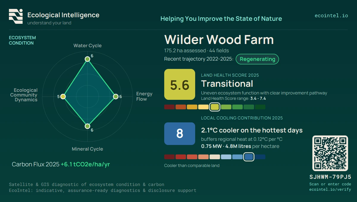
- Land Health Score
- 5.6 Transitional Trajectory: Steady
- Net carbon
- +6.1 tCO2e/ha/yr
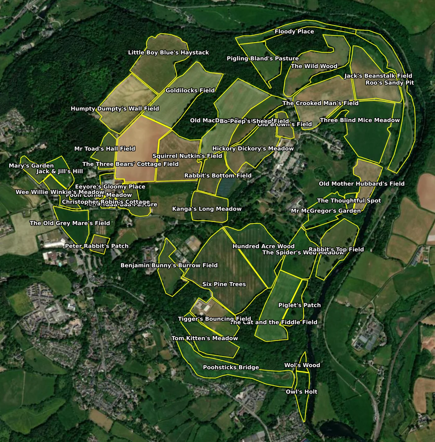
Wilder Wood Farm is EcoIntel’s public demonstration property. It is a mixed lowland estate: thirty-eight grassland parcels, two agroforestry alley-cropping fields, two wood-pasture parkland blocks, wet meadows along the river, and a set of rotational fields, worked as a single farm across 175 hectares. Eight continuous years of satellite history sit behind every figure on this page.
Anyone can open the full report suite for this property on the free demo plan: the same scoring engine, the same analysis, and the same credential a paying subscriber sees for their own land. It is the one property whose data appears publicly on this site.
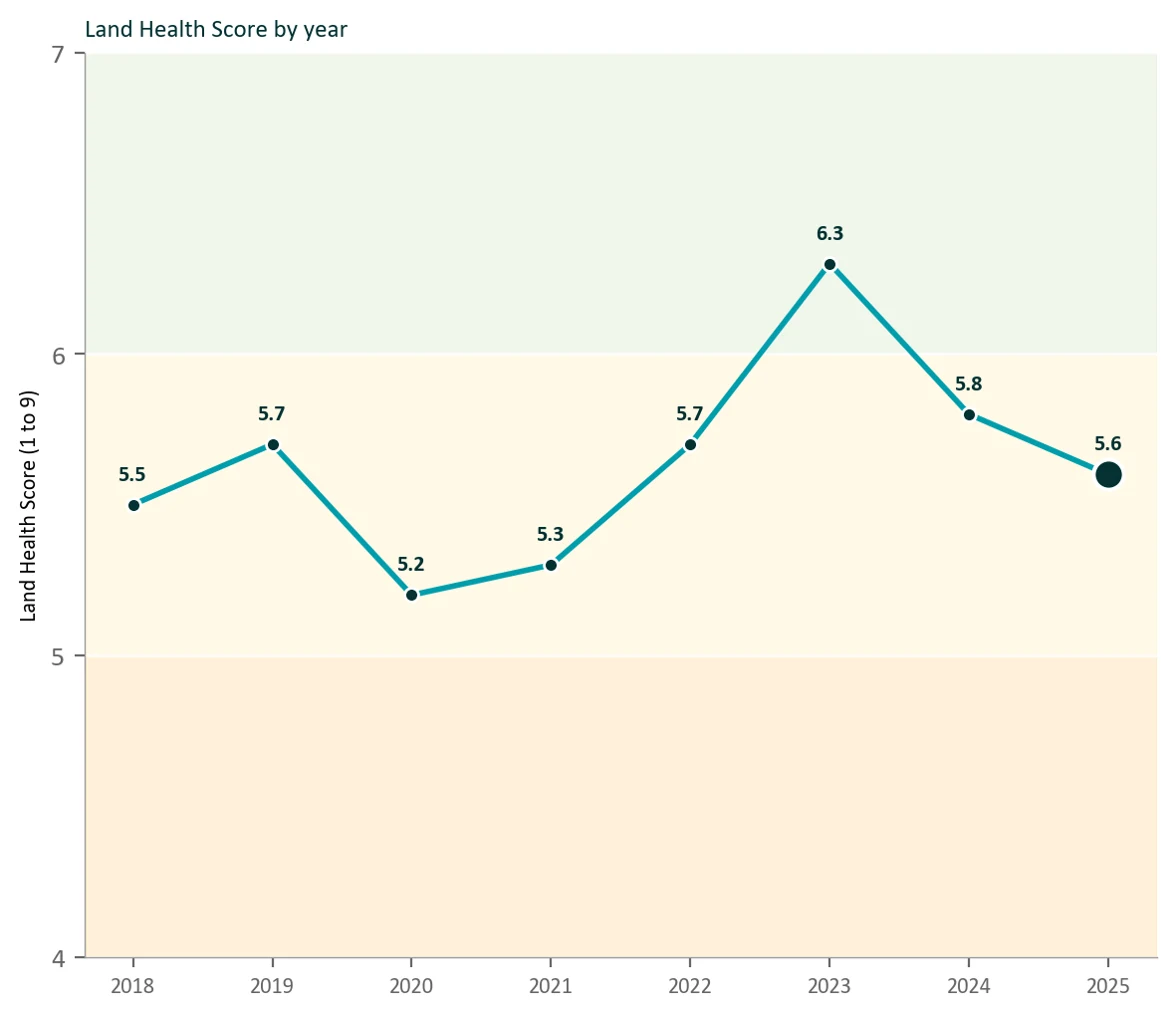
Trajectory: Steady (Mid)
The Land Health Score across the 2018 to 2025 satellite record.
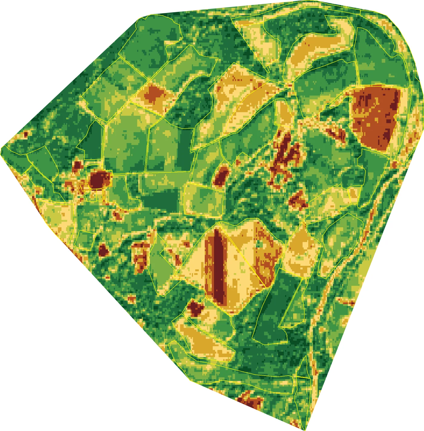
Four ecosystem processes
The water cycle, energy flow, mineral cycle and community dynamics, each on the 1 to 9 Land Health scale. Switch land-use track:
Land health classification
- 9 Flourishing
- 8 Thriving
- 7 Healthy
- 6 Recovering
- 5 Transitional
- 4 Stressed
- 3 Degraded
- 2 Depleted
- 1 Collapsed
Local cooling contribution
4.4 to 7.1 (average 6.2)
Steady local cooler
cooler than its surroundings
Wilder Wood Farm moves about 839 million litres of water into the air over the growing season, roughly 73% of it through living plants. That evaporation is about 131 MW of cooling.
- 839M L Water moved into the air, per season
- 131 MW Cooling power while it does this
- 73% Cooling done by living plants, not bare soil
- 19%typical Sunlight reflected; the cooling leans on evaporation
- 30 wks Weeks of active green cooling, typical field
- 14.9 °C Cooler than its hottest bare surfaces in summer
Per hectare 0.75 MW cooling 4.8M litres water
The EcoIntel Land Health Credential in Machine-readable Format
EcoIntel's Land Health credentials are available as a machine-readable W3C Verifiable Credential and as JSON, independently verifiable against our published key, so an AI-agent can consume and trust them as-is.
- Verifiable Credential 2.0 application/vc+ld+json, eddsa-jcs-2022
- Credential record application/json
- Issuer key did:web:www.ecointel.io
- Verify a credential file in your browser
The EcoIntel Land Health Credential is an independent, satellite- and GIS-evidenced assessment of ecosystem functioning.